CPRC plays a critical role in developing data, maps, and geospatial analysis to help local governments make informed decisions about transportation, land use, demographics, employment, and more.
The CPRC Data team create and analyze different types of information -how many people live in an area, where people work, how they travel - to help our local governments decide where to build roads, transit, houses, job centers, and schools. Through tools like ArcGIS and open-source GIS software, staff help members and partners understand spatial relationships, patterns, and trends that can impact urban planning, infrastructure development, and disaster response.
All existing data and analysis is available to member governments upon request. Have a unique challenge that requires further information, analysis, or education involving data? Reach out to our team to discuss the project and if we can provide better context for decision-makers.
Click the tabs below to see recent projects.
Member County Profiles
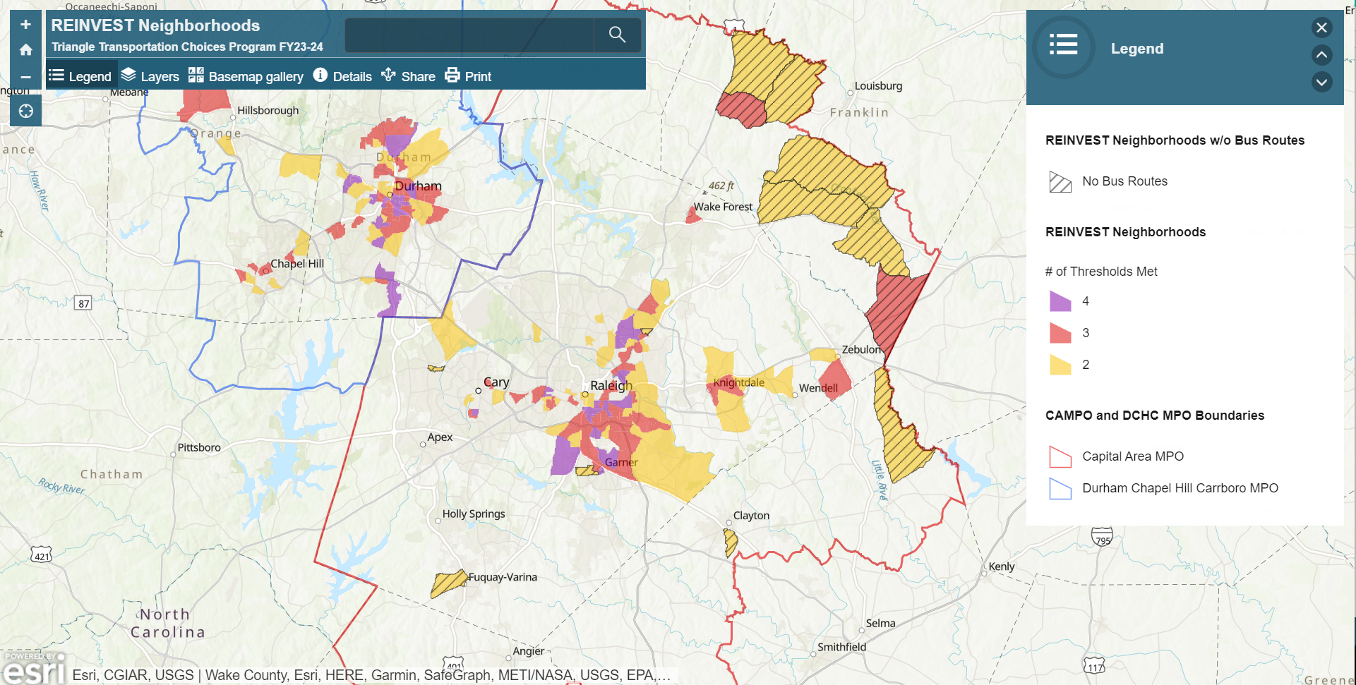
The REINVEST Neighborhoods map was created by Triangle J Council of Governments for the Triangle Transportation Choices Program to encourage more equitable residential-based outreach in neighborhoods that may have been previously overlooked; neighborhoods that are home to residents who are more likely to use and benefit from alternative transportation options due to their race/ethnicity (RE), income (IN), vehicle availability (VE), and/or status (ST).
The Transportation Choice Hubs map displays areas with the highest employment density in the Triangle region of central North Carolina based on 2018 jobs data from the U.S. Census Bureau’s Longitudinal Employer-Household Dynamics (LEHD) program. The map was created by Central Pines Regional Council for the Triangle Transportation Choices program to aid local and regional Transportation Demand Management (TDM) service providers in prioritizing employer-based TDM outreach within their service coverage areas.
This toolkit is meant to provide users with information and resources on how to finance and complete a brownfields redevelopment project. The following sections, all related to brownfield redevelopment and land revitalization, address: 1. common myths; 2. definitions for commonly used terms; 3. phases of brownfields redevelopment and the stakeholders involved; 4. funding sources; 5. equitable practices; 6. case studies; and 7. brownfields redevelopment scenarios.
Recommended Datasets
The following publicly-available datasets can help local planners and decision-makers better understand the region and visualize its future.
National Data
US Census Bureau (Data Homepage)
- American Community Survey (ACS)
- Census Flows Mapper
- Decennial Census of Population & Housing
- Economic Census
- Explore Census Data (previously American FactFinder)
- OnTheMap
- OnTheMap for Emergency Management
State Data
NC Department of Transportation (DOT)
NC Flood Risk Information System (FRIS)